Introduction
Geofencing Tools are software platforms that use GPS, RFID, Wi-Fi, cellular data, or IoT technologies to create virtual geographic boundaries around physical locations. These platforms automatically trigger actions, notifications, workflows, analytics, or security controls when people, vehicles, mobile devices, drones, or assets enter or leave defined geographic zones.
Modern organizations increasingly rely on geofencing technologies for workforce tracking, logistics optimization, retail marketing, smart city operations, security management, fleet monitoring, and location-based automation. Traditional location tracking alone is no longer sufficient for real-time operational workflows. Today’s geofencing platforms combine AI-driven analytics, IoT integrations, GIS mapping, mobile tracking, automation engines, and cloud-based telemetry to support advanced operational intelligence and real-time decision-making.
Real-world use cases include:
- Fleet and logistics monitoring
- Employee attendance and workforce automation
- Retail proximity marketing campaigns
- Drone flight restriction enforcement
- Smart city and public safety operations
Buyers evaluating Geofencing Tools should focus on:
- Real-time geofencing accuracy and reliability
- GIS and mapping integration support
- Automation and workflow triggering capabilities
- Mobile and IoT device compatibility
- Scalability for large asset or user volumes
- Analytics and reporting functionality
- API ecosystem and third-party integrations
- Security and compliance controls
- Battery and device efficiency optimization
- Multi-platform deployment flexibility
Best for: Logistics companies, retailers, smart city programs, transportation providers, security teams, drone operators, field workforce organizations, and enterprises requiring real-time location-based automation.
Not ideal for: Organizations that only require static location tracking without event-based automation or geospatial workflow management.
Key Trends in Geofencing Tools
- AI-assisted geospatial automation improving operational intelligence
- Real-time IoT geofencing expanding industrial monitoring capabilities
- Cloud-native geofencing platforms replacing device-specific systems
- Mobile workforce automation driving geofencing adoption in enterprises
- Drone geofencing becoming critical for UAV compliance and safety
- Edge computing reducing geofencing latency for real-time operations
- GIS integrations enabling richer spatial intelligence workflows
- Predictive analytics improving logistics and movement forecasting
- Privacy and compliance regulations influencing location data management
- Smart city and connected infrastructure projects increasing geofencing usage
How We Selected These Tools (Methodology)
- Adoption across logistics, retail, workforce, and IoT industries
- Real-time geofencing accuracy and scalability
- GIS and mapping integration capabilities
- Automation and event-triggering flexibility
- API ecosystem and developer support
- Mobile and IoT compatibility
- Security and privacy management features
- Analytics and reporting capabilities
- Enterprise deployment flexibility
- Balance between enterprise, developer-focused, and cloud-native solutions
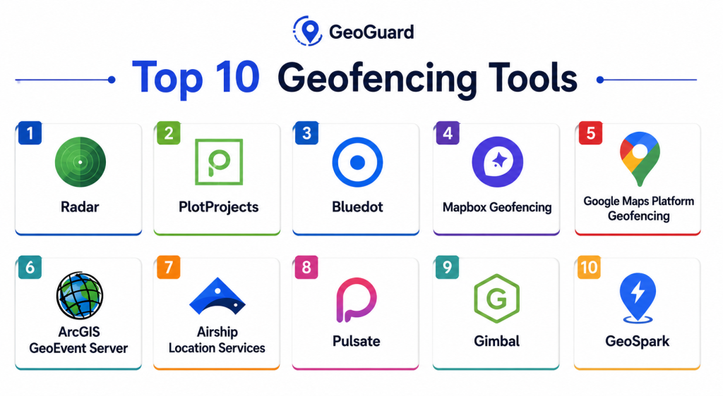
Top 10 Geofencing Tools
1- Radar
Short description:
Radar is a modern location infrastructure platform providing enterprise geofencing, trip tracking, and real-time location intelligence for mobile applications and operational workflows.
Key Features
- Real-time geofencing engine
- Trip tracking capabilities
- SDKs for mobile platforms
- Battery-efficient location tracking
- AI-powered fraud detection
- Event-trigger automation
- Analytics dashboards
Pros
- Excellent mobile performance
- Strong developer ecosystem
- High geofencing accuracy
Cons
- Developer-focused setup
- Premium enterprise pricing
- Requires integration expertise
Platforms / Deployment
- Web / Android / iOS
- Cloud
Security & Compliance
Supports secure APIs, RBAC, encryption, and privacy-focused location controls.
Integrations & Ecosystem
Integrates with mobile apps, cloud infrastructure, CRM systems, and analytics tools.
- APIs
- Mobile SDKs
- Cloud services
- CRM platforms
- Analytics tools
Support & Community
Strong developer documentation and enterprise support ecosystem.
2- PlotProjects
Short description:
PlotProjects provides location-based engagement and geofencing tools for retail, transportation, smart city, and customer experience applications.
Key Features
- Real-time geofencing triggers
- Indoor and outdoor positioning
- Customer engagement automation
- Mobile SDK integration
- Beacon support
- Campaign analytics
- Event automation workflows
Pros
- Strong mobile engagement workflows
- Good indoor positioning support
- Easy integration capabilities
Cons
- More marketing-focused workflows
- Limited industrial use cases
- Advanced analytics require premium plans
Platforms / Deployment
- Android / iOS / Web
- Cloud
Security & Compliance
Supports secure APIs and encrypted communication workflows.
Integrations & Ecosystem
- Mobile SDKs
- CRM platforms
- Analytics systems
- APIs
Support & Community
Strong retail and mobile engagement ecosystem.
3- ArcGIS GeoEvent Server
Short description:
ArcGIS GeoEvent Server provides enterprise-grade real-time geofencing, spatial analytics, and IoT event processing within the ArcGIS ecosystem.
Key Features
- Real-time geofencing analytics
- IoT data stream processing
- GIS integration workflows
- Spatial event automation
- Real-time dashboards
- Asset monitoring tools
- Enterprise GIS analytics
Pros
- Industry-leading GIS integration
- Excellent real-time analytics
- Strong IoT compatibility
Cons
- Requires GIS expertise
- Complex enterprise deployment
- Premium licensing costs
Platforms / Deployment
- Web / Windows / Linux
- Hybrid / Self-hosted
Security & Compliance
Supports RBAC, MFA, encryption, and enterprise authentication controls.
Integrations & Ecosystem
- ArcGIS ecosystem
- IoT platforms
- APIs
- GIS databases
- Analytics tools
Support & Community
Massive enterprise GIS support ecosystem.
4- Airship Location Services
Short description:
Airship provides geofencing and mobile engagement capabilities focused on personalized customer experiences and location-based automation.
Key Features
- Geofence-triggered notifications
- Mobile engagement workflows
- Real-time user segmentation
- Journey automation
- Location analytics
- SDK integration support
- Campaign management tools
Pros
- Strong customer engagement workflows
- Excellent mobile integrations
- Good automation flexibility
Cons
- Primarily marketing-focused
- Less industrial geospatial depth
- Enterprise pricing model
Platforms / Deployment
- Android / iOS / Web
- Cloud
Security & Compliance
Supports secure APIs, encryption, and mobile authentication controls.
Integrations & Ecosystem
- Mobile platforms
- CRM systems
- APIs
- Marketing automation tools
Support & Community
Strong mobile engagement and enterprise support ecosystem.
5- GeoFencing by Gimbal
Short description:
Gimbal provides enterprise geofencing and proximity marketing solutions designed for retail, hospitality, and location-based customer engagement.
Key Features
- Geofence event triggering
- Beacon and proximity support
- Customer analytics
- Mobile engagement tools
- Real-time location intelligence
- Campaign management
- Audience segmentation
Pros
- Strong retail engagement workflows
- Good proximity marketing capabilities
- Reliable mobile SDK support
Cons
- Limited industrial applications
- Less GIS-focused functionality
- Smaller enterprise ecosystem
Platforms / Deployment
- Android / iOS / Web
- Cloud
Security & Compliance
Supports encrypted communications and secure API management.
Integrations & Ecosystem
- CRM systems
- Mobile SDKs
- APIs
- Marketing platforms
Support & Community
Strong retail and customer engagement support network.
6- HERE Location Services
Short description:
HERE Location Services provides geofencing, mapping, routing, and real-time location intelligence capabilities for logistics and enterprise applications.
Key Features
- Enterprise geofencing APIs
- Routing and navigation tools
- Real-time location tracking
- Fleet management integration
- GIS visualization support
- Location analytics
- Cloud-native APIs
Pros
- Strong mapping ecosystem
- Excellent logistics support
- Enterprise-grade scalability
Cons
- API-focused deployment model
- Requires developer expertise
- Advanced usage costs can increase quickly
Platforms / Deployment
- Web / Mobile
- Cloud
Security & Compliance
Supports secure APIs, RBAC, and enterprise-grade cloud security controls.
Integrations & Ecosystem
- Fleet platforms
- APIs
- GIS systems
- IoT services
- Mobile applications
Support & Community
Strong enterprise location intelligence ecosystem.
7- Google Maps Platform Geofencing
Short description:
Google Maps Platform provides geofencing and location intelligence APIs for mobile apps, logistics, retail, and enterprise operational workflows.
Key Features
- Geofencing APIs
- Real-time location services
- Mobile SDK integrations
- Mapping and routing support
- Event automation workflows
- Analytics tools
- Cloud scalability
Pros
- Massive developer ecosystem
- Strong cloud scalability
- Reliable mapping infrastructure
Cons
- Usage-based pricing complexity
- Requires API development expertise
- Limited enterprise governance workflows
Platforms / Deployment
- Web / Android / iOS
- Cloud
Security & Compliance
Supports secure APIs, cloud authentication, and encrypted communications.
Integrations & Ecosystem
- Google Cloud
- APIs
- Mobile applications
- Analytics tools
Support & Community
Large global developer ecosystem and documentation library.
8- Wialon
Short description:
Wialon is a fleet management and telematics platform offering advanced geofencing, asset tracking, and operational monitoring capabilities.
Key Features
- Fleet geofencing workflows
- Asset movement monitoring
- Vehicle tracking dashboards
- IoT telematics integrations
- Real-time alerts
- Driver behavior analytics
- Operational reporting
Pros
- Excellent fleet tracking support
- Strong IoT compatibility
- Good operational visibility
Cons
- More fleet-focused than general-purpose
- Complex advanced configurations
- Smaller global ecosystem than larger cloud vendors
Platforms / Deployment
- Web / Mobile
- Cloud / Self-hosted
Security & Compliance
Supports encryption, RBAC, and operational audit controls.
Integrations & Ecosystem
- IoT devices
- APIs
- Fleet systems
- GIS platforms
Support & Community
Strong telematics and fleet management ecosystem.
9- GeoSpark
Short description:
GeoSpark provides location APIs and geofencing infrastructure for logistics, mobility, and enterprise location-based applications.
Key Features
- Real-time geofencing APIs
- Mobile location tracking
- Route optimization tools
- Event-based automation
- SDK integrations
- Analytics dashboards
- Battery optimization support
Pros
- Strong mobility workflows
- Good API performance
- Developer-friendly integrations
Cons
- Requires technical expertise
- Smaller enterprise ecosystem
- Limited advanced GIS analytics
Platforms / Deployment
- Android / iOS / Web
- Cloud
Security & Compliance
Supports secure APIs, authentication, and encrypted data transfer.
Integrations & Ecosystem
- APIs
- Mobile SDKs
- Logistics systems
- Analytics tools
Support & Community
Growing mobility and location intelligence ecosystem.
10- FlyFreely Geofencing
Short description:
FlyFreely provides operational geofencing capabilities for drone operations, compliance management, and aviation safety workflows.
Key Features
- UAV geofencing controls
- Airspace compliance workflows
- Drone operational monitoring
- Real-time alerts
- Flight boundary enforcement
- Compliance automation
- Operational dashboards
Pros
- Strong UAV safety workflows
- Good compliance automation
- Reliable operational visibility
Cons
- Specialized drone-focused use cases
- Limited non-UAV workflows
- Smaller ecosystem compared to larger GIS platforms
Platforms / Deployment
- Web
- Cloud
Security & Compliance
Supports secure authentication, encryption, and operational audit controls.
Integrations & Ecosystem
- Drone platforms
- GIS systems
- APIs
- Aviation systems
Support & Community
Growing enterprise UAV operations ecosystem.
Comparison Table
| Tool Name | Best For | Platforms Supported | Deployment | Standout Feature | Public Rating |
|---|---|---|---|---|---|
| Radar | Enterprise mobile geofencing | Web, Mobile | Cloud | High-accuracy tracking | N/A |
| PlotProjects | Customer engagement | Mobile, Web | Cloud | Indoor positioning | N/A |
| ArcGIS GeoEvent Server | Enterprise GIS geofencing | Web, Windows | Hybrid | Real-time spatial analytics | N/A |
| Airship | Mobile engagement automation | Mobile, Web | Cloud | Personalized notifications | N/A |
| Gimbal | Proximity marketing | Mobile, Web | Cloud | Beacon integration | N/A |
| HERE Location Services | Enterprise logistics | Web, Mobile | Cloud | Routing intelligence | N/A |
| Google Maps Platform | Developer geofencing APIs | Web, Mobile | Cloud | Massive ecosystem | N/A |
| Wialon | Fleet tracking | Web, Mobile | Hybrid | Telematics integration | N/A |
| GeoSpark | Mobility operations | Mobile, Web | Cloud | Battery optimization | N/A |
| FlyFreely | UAV compliance | Web | Cloud | Drone geofencing | N/A |
Evaluation & Scoring of Geofencing Tools
| Tool Name | Core 25% | Ease 15% | Integrations 15% | Security 10% | Performance 10% | Support 10% | Value 15% | Weighted Total |
|---|---|---|---|---|---|---|---|---|
| Radar | 9.4 | 8.6 | 9.2 | 9.0 | 9.3 | 9.1 | 8.5 | 9.0 |
| PlotProjects | 8.6 | 8.8 | 8.3 | 8.4 | 8.5 | 8.5 | 8.7 | 8.5 |
| ArcGIS GeoEvent Server | 9.5 | 7.5 | 9.6 | 9.3 | 9.4 | 9.5 | 7.9 | 9.0 |
| Airship | 8.7 | 8.9 | 8.5 | 8.7 | 8.8 | 8.8 | 8.3 | 8.6 |
| Gimbal | 8.4 | 8.7 | 8.2 | 8.4 | 8.5 | 8.4 | 8.5 | 8.4 |
| HERE Location Services | 9.0 | 8.1 | 9.3 | 9.0 | 9.1 | 9.0 | 8.2 | 8.8 |
| Google Maps Platform | 8.9 | 8.3 | 9.4 | 8.9 | 9.2 | 9.1 | 8.1 | 8.8 |
| Wialon | 8.8 | 8.0 | 8.8 | 8.7 | 8.9 | 8.8 | 8.4 | 8.7 |
| GeoSpark | 8.5 | 8.5 | 8.4 | 8.5 | 8.6 | 8.4 | 8.8 | 8.5 |
| FlyFreely | 8.3 | 8.4 | 8.0 | 8.8 | 8.5 | 8.3 | 8.7 | 8.4 |
These scores are comparative and designed to help organizations evaluate geofencing platforms based on real-time accuracy, scalability, integrations, automation capabilities, security, usability, and long-term operational value.
Which Geofencing Tool Is Right for You?
Solo / Small Businesses
Best suited: Google Maps Platform, GeoSpark
These provide flexible APIs and cost-effective geofencing capabilities for lightweight applications.
SMB / Mobile Operations
Best suited: PlotProjects, Radar, Airship
These balance usability, engagement automation, and operational flexibility.
Mid-Market Enterprises
Best suited: HERE Location Services, Wialon, Radar
These provide stronger integrations, fleet workflows, and analytics capabilities.
Enterprise / Government Programs
Best suited: ArcGIS GeoEvent Server, HERE, FlyFreely
These offer enterprise scalability, GIS intelligence, and advanced operational governance.
Budget vs Premium
Budget-friendly: Google Maps Platform, GeoSpark
Premium enterprise: ArcGIS GeoEvent Server, Radar, HERE
Feature Depth vs Ease of Use
Deep analytics: ArcGIS GeoEvent Server, HERE
Ease of use: PlotProjects, Airship
Integrations & Scalability
Best integrations: ArcGIS, Google Maps Platform, HERE
Best scalability: Radar, ArcGIS, HERE
Security & Compliance Needs
Organizations managing sensitive operational or workforce location data should prioritize platforms supporting RBAC, MFA, encrypted APIs, audit logging, and privacy-focused governance controls.
Frequently Asked Questions
1. What is geofencing?
Geofencing is a technology that creates virtual geographic boundaries and triggers actions when devices or assets enter or leave those areas.
2. Why are geofencing tools important?
They help automate workflows, improve operational visibility, enhance customer engagement, and support real-time location-based intelligence.
3. Can geofencing tools integrate with GIS systems?
Yes, many enterprise geofencing platforms integrate with GIS and mapping systems for advanced spatial workflows.
4. Are cloud-based geofencing platforms common?
Yes, cloud-native geofencing platforms are widely used because they support scalability and real-time monitoring.
5. What security features are important?
Encryption, RBAC, secure APIs, MFA, and audit logging are critical for protecting sensitive location and operational data.
6. What industries use geofencing the most?
Logistics, retail, transportation, workforce management, public safety, drone operations, and smart city initiatives commonly use geofencing platforms.
7. Can geofencing support IoT devices?
Yes, many modern platforms integrate with IoT sensors, telematics systems, and connected infrastructure devices.
8. What are common implementation challenges?
Battery optimization, GPS accuracy, integration complexity, privacy compliance, and real-time scalability are common challenges.
9. Can geofencing automate workflows?
Yes, geofencing can automatically trigger alerts, workflows, notifications, analytics events, and operational actions.
10. How should organizations choose a geofencing platform?
Organizations should evaluate accuracy, scalability, integrations, analytics capabilities, operational workflows, security, and long-term infrastructure needs.
Conclusion
Geofencing Tools have become essential operational technologies for enterprises, governments, logistics providers, retailers, and smart city initiatives seeking real-time location intelligence and workflow automation capabilities. Modern geofencing platforms now combine AI-driven analytics, cloud-native APIs, GIS integrations, IoT connectivity, predictive analytics, and automation workflows to support increasingly advanced operational environments. Enterprise solutions such as Radar, ArcGIS GeoEvent Server, and HERE Location Services provide strong scalability and deep integration ecosystems, while platforms like PlotProjects and GeoSpark offer lightweight and developer-friendly deployment models. The best solution ultimately depends on operational scale, technical expertise, compliance requirements, integration priorities, and automation goals. A structured evaluation process combined with pilot deployments and real-world workflow testing can significantly improve long-term geofencing implementation success and operational efficiency.